Leisure & Recreation - Oberes Glantal
Warmfreibad Waldmohr – Heated Outdoor Pool Waldmohr
Address: Badstrasse 12, 66914 Waldmohr
Website: www.freibad-waldmohr.de
Phone: +49 (6373) 8917134
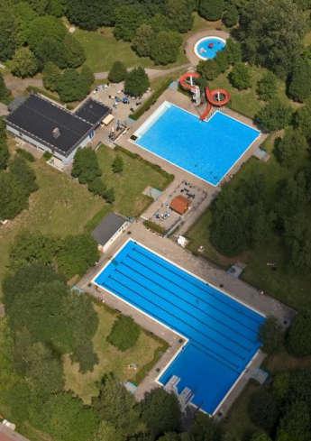
A visit to the Waldmohr heated outdoor pool guarantees fun for the whole family. The swimmer’s pool has a length of 50 meters. A 45 meters long water slide leads into the non-swimmers‘ pool. The diving tower has three different altitudes: 1 meter, 3 meters, and 5 meters. The little ones will enjoy the baby pool with play equipment. The large lawn area provides enough space to relax, have fun, and do sports. You will find a playground, a beach volleyball and basketball field, soccer goals, and ping-pong tables.
Opening hours:
May and September 9.00 a.m. – 7.00 p.m.
June/ July/ August 9.00 a.m. – 8.00 p.m.
Ticket office closing time one hour before closure!
Closed in adverse weather!
For admission fees please check the website.
By loading the card, you accept Google's privacy policy.
Learn more
Solar-heated Outdoor Pool Matzenbach
Address: Glantrasse, 66909 Matzenbach/ District Gimsbach
Website: www.matzenbach.de
Phone: +49 (6383) 7620
Parking: Please park your car at the parking lot at the church in Gimsbach.
It is just a two minutes‘ walk to the pool from there!
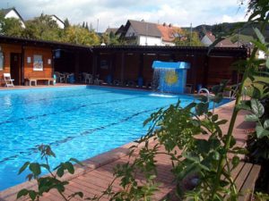
The solar-heated outdoor pool is run and managed by the community. Besides the small pool with a hot water fountain, you will find a wading pool for kids. The cozy lawn area next to the pool is the right place to take a rest. A table football, a ping-pong table, and a chessboard square are available as well. A Kneipp water-treading basin is located next to the pool. Throughout the summer months, special night swimming events are offered – on these days the pool stays open until midnight.
Opening hours:
In pleasant weather from 3.00 p.m. to 8.00 p.m. daily.
On Saturday, Sunday and throughout the German school holidays the pool already opens at 1.00 p.m.
Special openings for school classes and groups can be arranged on request.
For admission fees please check the website.

By loading the card, you accept Google's privacy policy.
Learn more
Ohmbachsee – Lake Ohmbach
Address: 66901 Schönenberg-Kübelberg/ District Sand and 66903 Gries
Website (in German): www.vgog.de
Phone: +49 (6373) 5040
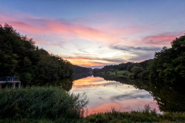
Lake Ohmbach is located next to Schönenberg-Kübelberg (district Sand) and Gries. The recreation area is the perfect location to relax, have fun, and celebrate. The artificial lake was laid out in 1975. It has a water surface of 15 hectares. The lake is 1.5 kilometers long and up to 300 meters wide. A walking trail of 3.5 kilometers that is unhampered by barriers leads around the lakeshore. Lake Ohmbach is not a bathing lake, but it is suitable for boating and fishing.
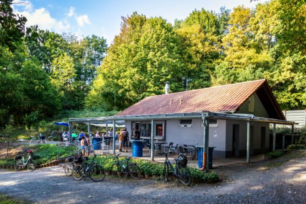
From May until October pedal boats are rented out at the kiosk at the playground (phone: +49 (151) 27575799). Rental fee is €4 for 30 minutes and €3 for every additional 30 minutes or part thereof. Troughout the summer months the kiosk is open from 11 a.m. to 8 p.m. In rainy and inclement weather the kiosk might be closed.
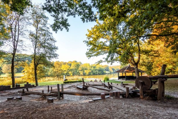
Children will enjoy the water playground with a giant slide. Various barbecue areas equipped with tables and benches can be used free of charge. An ample cabin at the lakeshore in Gries offers space for events for up to 400 people and has two roofed barbecue areas. Two kiosks cater for the visitors and the lawn area surrounding the lake is perfect for sunbathing. Campingpark “Jungfleisch” , which includes a restaurant, hotel, and 320 pitches for camping is the perfect location for an overnight stay. Fun for the whole family is guaranteed! A special event attracting visitors from near and far is the romantic Ohmbach Lake Festival. It takes place each year on the third weekend in July and lasts three days.

By loading the card, you accept Google's privacy policy.
Learn more
Begehbares Geschichtsbuch – Accessible History Book
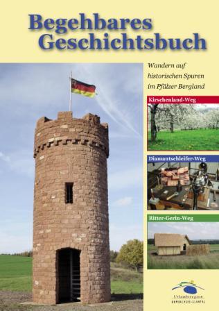
Along five loop trails, 3.000 years of history come to life in the Oberes Glantal Union Community. The loop trails are called Diamantschleiferweg (Diamond Cutter Trail), Kirschenlandwanderweg (Cherry County Hiking Trail), and Ritter Gerin Weg (Knight Gerin Trail). In spring 2021 two new trails will be added: The Bergmannsbauernweg (Miner’s and Farmer’s Trail) and the Weg-Jüdische Kultur (Hiking Trail Jewish Culture). At various locations, this “Accessible History Book“ shows the historic development of the region as well as distinctive scenic spots. Information boards, as well as replicas of historical sites, illustrate historical, geological, and topographical features.
Kirschenland-Wanderweg – Cherry County Hiking Trail
Start/Finish: Parking lot behind the Kirschenland Museum
Address: Friedhofstrasse 3, 66903 Altenkirchen
Length: 20 kilometers
Website: www.vgog.de
Phone: +49 (6373) 5040
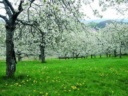
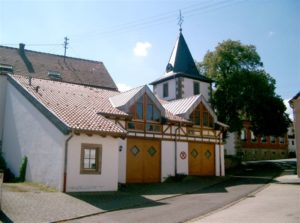
The “Kirschenland” (engl. Cherry County) hiking trail leads on a circular route of about 20 kilometers (12.5 miles) through the districts of the three Kohlbachtal communities Altenkirchen, Dittweiler, and Frohnhofen. The landscape is characterized by extensive orchards. In old records, the Kohlbachtal is also called “Orchard of the Westrich”. From the 19th century on, sweet cherries were cultivated to a greater extent. This is where the name of the hiking trail derived from. Although fruit cultivation has declined substantially in recent years, more than 30,000 fruit trees, including 15,000 cherry trees, are still flourishing in the Kohlbachtal Valley each year in May. The trail leads to the nice recreational areas Entenweiher in Frohnhofen, Höbelgraben in Altenkirchen, Römerweiher and Elschbrunnen in Dittweiler. The museum of local history in Altenkirchen shows a nice collection of what everyday life in previous times was like and documents the emigration from the local area to America. Another historic landmark along the trail is the Protestant church in Altenkirchen with its distinctive curved tower dome. Parts of the tower date back to Roman times. The nave was built in 1756. In the Ahlenwald forest near Altenkirchen, you can still see adits of a former coal mine. On a summit with a height of 375 meters, between the communities Dittweiler und Altenkirchen, a replica of a medieval watchtower was built. The tower offers a great view of the surrounding area.


The map shown here is provided by tourenplaner-rheinland-pfalz.de. This is a third party provider. tourenplaner-rheinland-pfalz.de uses Outdooractive. By loading the map, you accept the privacy policy of Outdooractive.
Learn more about Outdooractive | Tourenplaner-rheinland-pfalz.de
Diamantschleifer-Weg – Diamond Cutter Hiking Trail
Start/Finish: Diamond Cutter Museum Brücken
Address: Hauptstrasse 47, 66904 Brücken
Length: 18 kilometers
Website: www.vgog.de
Phone: +49 (6373) 5040
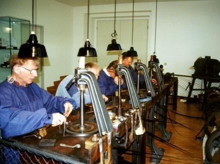
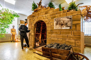
Since 1888 the village of Brücken had been the center of the diamond industry in the local area. In the 1930s, more than 2,500 people were employed in the diamond cutting industry of the Western Palatinate. The Diamond Cutter Trail is a circular route with a length of 18 kilometers (11.2 miles) that leads through the districts of the villages Brücken and Ohmbach in the Ohmbach Valley. Along the hiking trail, you can follow the traces of stones. In the Catholic parish church of Brücken (built 1953-55), you can see the largest altar mosaic of the Palatinate. It is made up of over 30,000 small stones of Italian marble. The mining tunnel in Brücken reminds hikers of the coal mine that was operated here from 1775 until 1939. Further stony witnesses are old boundary stones dating from the year 1786 and the filled-up concrete remains of old Siegfried Line bunkers. The stone quarry near Ohmbach indicates that in the 19th century sandstone slabs were quarried here and used as floor coverings. An exciting presentation of the historical and economic development of the Palatinate diamond industry awaits you at the Diamond Cutter Museum in Brücken. The museum was opened in 1999. On Sunday afternoons diamond cutters demonstrate each step in the diamond cutting process. At several fully functional work stations representing different historical and technical periods, they illustrate the transformation of rough diamonds into brilliant gems. True to original replicas of the 40 largest and most important diamonds of the world are displayed. Children will enjoy the museum´s “treasure chest”, where they can search for gemstones.


The map shown here is provided by tourenplaner-rheinland-pfalz.de. This is a third party provider. tourenplaner-rheinland-pfalz.de uses Outdooractive. By loading the map, you accept the privacy policy of Outdooractive.
Learn more about Outdooractive | Tourenplaner-rheinland-pfalz.de
Ritter-Gerin-Weg – Knight Gerin Hiking Trail
Start/Finish: Kulturhaus Kübelberg
Address: Kirchengasse 1-3, 66901 Schönenberg-Kübelberg
Length: 30.5 kilometers
Website: www.vgog.de
Phone: +49 (6373) 5040
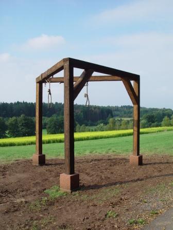
The 30.5 kilometers (approx. 19 miles) long Ritter Gerin Hiking Trail leads through the communities of Schönenberg-Kübelberg and Gries. Ritter Gerin who gave the trail its name was a knight of a noble family from Kübelberg. Already in the Early Middle Ages, a motte-and-bailey castle was located in Kübelberg. It was first mentioned in a document in 1297. Ensuing from this castle, the market town of Kübelberg developed to a place of trial responsible for 12 villages. Witnesses of the judiciary are the replica of a medieval gallows near the district Sand, a place of execution named “Rabentisch” located on a hill of 15 meters height near Schönenberg and the pillory in Kübelberg. Besides that, Ritter Gerin Hiking Trail leads to Lake Ohmbach, with 15 hectares, the largest water area in the Western Palatinate. Following the course of Ritter Gerin Trail, you will also be reminded of the former Glantalbahn. This railroad track was in service until 1984. Nowadays, the Glan-Blies Cycle Route leads along the track. Near Gries, the trail leads past the loop of the Glan River to the scenic Kühnerbachtal Valley, where a small population of wild orchids has survived. The trail offers views of the Catholic parish church of St. Valentine in Kübelberg. The construction of the tower dates back to the 12th century. The historic nave was built in the 18th century.


The map shown here is provided by tourenplaner-rheinland-pfalz.de. This is a third party provider. tourenplaner-rheinland-pfalz.de uses Outdooractive. By loading the map, you accept the privacy policy of Outdooractive.
Learn more about Outdooractive | Tourenplaner-rheinland-pfalz.de
Bergmannsbauern-Weg – Miner‘s and Farmer‘s Hiking Trail
Start/Finish: Bergmannsbauernmuseum
Address: Waldmohrer Strasse 32, 66916 Breitenbach
Length: 32.5 kilometers
Website: www.vgog.de
Phone: +49 (6373) 5040
The Bergmannsbauern hiking trail has a total length of 32.5 kilometers (20.2 miles). It leads through the Höcherberg-Westrich nature reserve around the communities Breitenbach, Dunzweiler, and Waldmohr. The trail starts and finishes at the Miner’s and Farmer’s Museum in Breitenbach, which vividly documents the everyday life of the farmers in former times. From there, it leads partly along the old miner’s paths, passing historic miner’s houses. Other landmarks along the trail are relics of mining, such as the district of the village of Breitenbach called Grube Labach (the name of a former mine), or the 70 m long and 6 m high loading station of the former Nordfeld Mine in the forest of Waldmohr. Throughout the course of the trail you have to master an altitude difference of 660 meters in total.
The trail is still in process of planning – the opening is scheduled for spring 2021!


The map shown here is provided by tourenplaner-rheinland-pfalz.de. This is a third party provider. tourenplaner-rheinland-pfalz.de uses Outdooractive. By loading the map, you accept the privacy policy of Outdooractive.
Learn more about Outdooractive | Tourenplaner-rheinland-pfalz.de
Weg-Jüdische Kultur – Hiking Trail Jewish Culture
Start/Finish: Jewish Museum
Address: Hauptstrasse 78, 66909 Steinbach
Length: 28 kilometers
Website: www.vgog.de
Phone: +49 (6373) 5040
The hiking trail “Jewish Culture” has a total length of 28 kilometers (17.4 miles). Throughout the course of the trail, you have to master an altitude difference of 460 meters in total. The trail links the two creeks Glan and Ohmbach. The trail starts and finishes at the Jewish Museum in Steinbach am Glan. The main purpose of the round trail is to recollect the Jewish population that lived in the area for centuries. It leads along sites and buildings that were evidently inhabited by Jews or were of special interest for the Jewish culture. The trail connects with two other hiking trails – the Diamond Cutter Trail and the Knight Gerin Trail.
The trail is still in process of planning – the opening is scheduled for spring 2021!


The map shown here is provided by tourenplaner-rheinland-pfalz.de. This is a third party provider. tourenplaner-rheinland-pfalz.de uses Outdooractive. By loading the map, you accept the privacy policy of Outdooractive.
Learn more about Outdooractive | Tourenplaner-rheinland-pfalz.de
Quality Trail "Traumtour Diamant" (Diamond Dream Tour)
Start/Finish: Diamond Cutter Museum Brücken
Address: Hauptstrasse 47, 66904 Brücken
Length: 15.2 kilometers
Website: www.vgog.de
Phone: +49 (6373) 5040
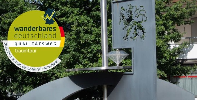
The „Traumtour Diamant“ is a quality trail, awarded with the certificate ‘Qualitätsweg Wanderbares Deutschland’. This certificate stands for carefree hiking enjoyment. The tour offers you a varied route, user-friendly trail marking, many close to nature trails, and paths to locations with an exciting history.
The award-winning hiking trail got its name “Traumtour Diamant” because of the Western Palatinate diamond cutting industry, which had its center in the village of Brücken since 1888. In the 1930s, more than 2500 people were employed in this sector in the Western Palatinate.
The trail takes you through a circular route over a distance of about 15 km (9.4 miles), through the Ohmbachtal communities of Brücken and Ohmbach. Here you can follow the traces of the stones. A fascinating view awaits you at and around the “Watchtower”. Other stony witnesses are old boundary stones from 1786 and the soil-covered concrete remains of old bunkers of the Siegfried Line. Of particular interest is the Diamond Cutter Museum in Brücken. Here, on Sundays, you can look over the shoulders of cutters working on diamonds. The museum with its connected gastronomy is the starting and endpoint of your hiking experience. Worth seeing is the coffee roastery in the historic mill building of the Reismühle Krottelbach. Guided visits and roasting demonstrations can be booked there. In addition, the courtyard of the Landcafé offers a fantastic backdrop.
The quality trail offers the perfect hiking experience for general interested, experienced hikers who want to walk attractive, varied trails. A mix of cultural and natural attractions along the way makes you forget everyday life!


The map shown here is provided by tourenplaner-rheinland-pfalz.de. This is a third party provider. tourenplaner-rheinland-pfalz.de uses Outdooractive. By loading the map, you accept the privacy policy of Outdooractive.
Learn more about Outdooractive | Tourenplaner-rheinland-pfalz.de
Glan-Blies-Radweg – Bike Trail
Locally the trail leads along Matzenbach, Glan-Münchweiler, Nanzdietschweiler, Bruchmühlbach-Miesau, Schönenberg-Kübelberg, Waldmohr
Website: www.glan-blies-weg.de
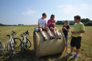
From Saarguemines in France to Staudernheim in Germany, this border-crossing bike trail of 130 km (81 miles) mainly leads along the rivers Glan and Blies. To a large extent, the route follows former railway tracks apart from road traffic. For this reason, the trail is ideal to cycle for families, but tour bikers also appreciate this fact.

The map shown here is provided by tourenplaner-rheinland-pfalz.de. This is a third party provider. tourenplaner-rheinland-pfalz.de uses Outdooractive. By loading the map, you accept the privacy policy of Outdooractive.
Learn more about Outdooractive | Tourenplaner-rheinland-pfalz.de
Bike Park Schönenberg-Kübelberg
Address: Stegwooger Weg, 66901 Schönenberg-Kübelberg
Website: www.schoenenberg-kuebelberg.de
Phone: +49 (6373) 5040
Parking: Dorplatz Schönenberg, Kirchgasse 2, 66901 Schönenberg-Kübelberg
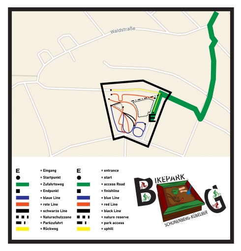
The bike park is a project of the municipality of Schönenberg-Kübelberg laid out by young people for young people. It is an extremely demanding trail that requires a high level of driving safety. The trail is definitely not suitable for beginners or less experienced users. Use is only permitted with a safety helmet, protectors and bicycles designed for this purpose. Before getting on the trail, it is mandatory to make yourself familiar with the terms of use and the safety information. For further information please visit the website www.schoenenberg-kuebelberg.de

By loading the card, you accept Google's privacy policy.
Learn more
Aviation Club Langenbach
Address: 66909 Langenbach
Website: www.fsv-kusel.de
Phone: +49 (06384) 6668
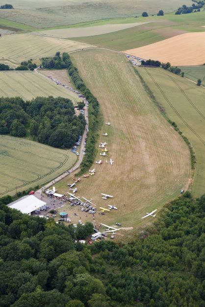
The Langenbach Aviation Club operates a glider airfield about 2 km south-west of the village of Langenbach. Langenbach is located in the Kusel county. The airfield of the Aviation Club has an 800m long grass track, which is regularly maintained by the club members. The main focus of the club is the training of young pilots. Sightseeing flights and familiarization flights with microlites, gliders and motorized airplanes are offered on request.

By loading the card, you accept Google's privacy policy.
Learn more

